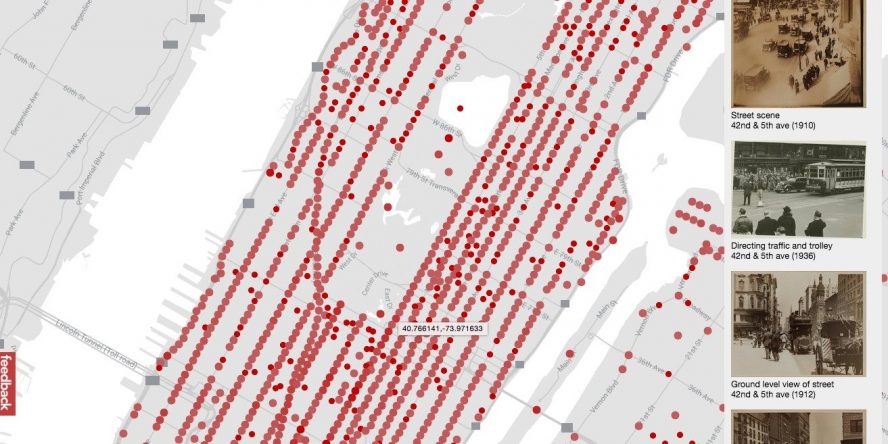
Imagine being able to travel back in time, and navigate your way through a vintage New York City via Google Maps.
Developer Dan Vanderkam, creator of the project OldNYC, has managed to come pretty close. Through an extensive collaboration with the New York Public Library, he gained access to over 80,000 photographs of New York City between the periods of 1870-1970.
Go check it out here. The only thing missing is Street View, but who knows what we’ll be able to experience in a few years.